From The Daily Journal’s Samantha Weigel, yet another article showing that many cities are dealing with “flood maps flux.” In many situations, adding ICC Certified Flood Flaps Flood Vents can keep premiums down.
As federal officials continue to reevaluate areas across San Mateo County they believe could be damaged during an extreme flood, various cities are left having to finance upgrades to their storm protection infrastructure or potentially face residents becoming subject to costly insurance mandates.
The Federal Emergency Management Agency released an updated riverine study map July 16 that covers portions of San Mateo, Redwood City, Burlingame, Foster City, San Carlos and Hillsborough. While each is affected differently, with some cities not experiencing any changes in the number of residents who are pulled into the Flood Insurance Rate Map, others are striving to navigate consistently changing requirements.
With little control over FEMA’s decisions, officials from various cities are even considering banding together as their infrastructure projects could impact neighboring communities.
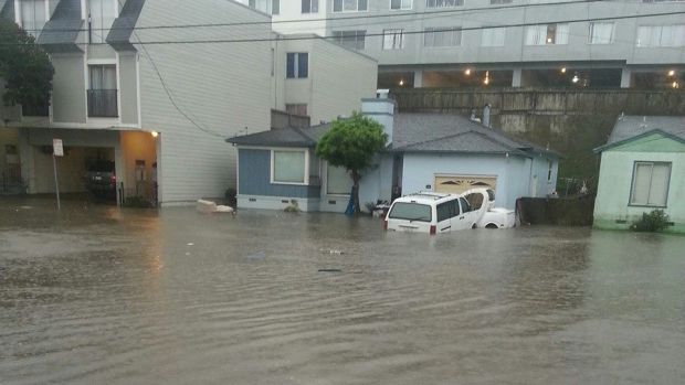
Bordered by both the Bay and ocean, San Mateo County has significant flooding history and risk. Over the last 30 years, the National Flood Insurance Program has paid out more than $6 million to individual property owner claims in the county, according to FEMA.
When FEMA identifies properties that could be impacted by a 100-year-storm, or a storm that has a 1 percent chance of occurring each year, it often triggers property owners with a federally-backed mortgage to purchase flood insurance.
New map, pending map
Yet even while the new map took effect this month, another preliminary Bay study map that covers low-lying coastal areas is anticipated to be released in August and could bring more portions of the county under FEMA’s mandates.
The Bay map study has preliminarily determined that nearly 80 percent of an 8-mile stretch of levees protecting 8,000 properties in San Mateo and 9,000 properties in Foster City is significantly deficient, according to FEMA.
“Currently, these levees do not provide adequate protection for residents in the immediate area and are not able to retain their federal levee accreditation as they are deficient by 1-4 feet,” according to FEMA.
Foster City officials will meet Monday to discuss improvements to the long-standing levees that have protected the city since it was incorporated and prevented any property owners from ever being subject to flood insurance, said Public Works Director Jeff Moneda.
Ideally, the city will seek an interim seclusion mapping designation that would buy time by keeping properties out of the flood zone as it makes the improvements, Moneda said.
Yet as FEMA consistently updates its maps, officials want to ensure whatever improvements are made will adhere to standards well into the future.
“We’ve got some interesting decisions to make when it comes to FEMA’s mapping and what we are prepared to do and how to best involve the residents with outreach, because it’s obviously going to require some sort of bond or investment from the residents,” Vice Mayor Gary Pollard said. “But we’re hoping if we do this, we won’t have to do it again for at least another 100 years.”
Councilman Herb Perez agreed, noting it’s important to collaborate with the neighboring San Mateo as both cities’ levees could offer some protection or impact the other.
San Mateo Deputy Mayor Jack Matthews, who’s been on the City Council since it began working with FEMA, agreed there should be a more regional approach.
“FEMA is not easy to deal with, let’s say, they can be autocratic. So there’s not a lot of appeal available once they decide on something,” Matthews said. “It is something that has to be dealt with and should be discussed amongst the various cities and coordinated so that what one city does, doesn’t negatively affect the other and maybe work together for positive change.”
San Mateo struggles
San Mateo has fought to adhere to FEMA’s requirements since 2001 when some residents were suddenly pulled into the flood zone and have been burdened by insurance rates as high as $8,000 a year. The city undertook nearly $23 million in improvements to levees, storm pumps and highway-related infrastructure that ultimately removed nearly 8,000 residents in the Shoreview neighborhood from the FIRM. Yet nearly 1,200 residents in the North Shoreview and North Central neighborhoods remain in the flood zone and the city is continuing to determine how to help while funds for repairs are less available then during its previous efforts.
For the first time, residual flooding from creeks or drains inundated with water during an extreme storm event was reflected in the riverine map released this month. The city’s updated FIRM removed about 110 properties from being subject to flood insurance but placed another 270 newly identified properties under FEMA’s orders.
Yet while San Mateo is directly impacted by the most recent map, other communities are not.
Burlingame, which does not have any levees, has not been affected by the July map, said Public Works Director Syed Murtuza.
However, the 2016 coastal map could significantly impact about 210 commercial properties and 22 residential properties, the majority of which are east of Rollins Road, Murtuza said.
Over the years, Burlingame has also undertook significant precautions through its 2009 $39 million Storm Drain Capital Improvement Project. Yet, those improvements were designed for covering 30-year storms, not the 100-year floods FEMA considers.
Already competing with FEMA’s changing terms, Murtuza noted there’s no federal funding provided to help explain the complex process to those who are directly impacted.
“The challenging part for the city is that FEMA does these updates of the map and we really have no control over what they do. And the education to the community, they just leave it to the city and there’s no funding for us to do any of that. Then we have to go explain this to the public and it’s really tough for us because we are not the body that makes these changes,” Murtuza said.
Burlingame has two flood zones that were identified by FEMA in 1981, the Laguna Flood Zone Area and the Easton Creek Flood Zone Area. Murtuza said he wasn’t sure exactly how many properties are subject to insurance, but the Daily Journal previously reported approximately 371 residential properties are located within the city’s two flood zones.
Redwood Shores impact
Redwood City also doesn’t appear to be significantly impacted by the new map, but the looming Bay coastal map could force the city to conduct some levee improvements if it wants to continue to keep certain Redwood Shore residents out of the flood zone. The city’s first FIRM was established in 1982 but FEMA updated the map in 2008. The city was then prompted to undertake Redwood Shores levee improvements in 2009 to achieve FEMA certification and prevent the imposition of mandatory flood insurance for residents, according to the city.
The recent map has highlighted that a small portion of the combined levee system may need improvements, however, to what extent and how much it may cost has yet to be determined, said the city’s spokeswoman Meghan Horrigan.
From what little information has been released for the coastal map, lower lying portions of the city, including an area of downtown, may be brought into the flood zone, Horrigan said.
Yet while FEMA has released preliminary information regarding the looming update of the coastal map that is anticipated to go into effect in 2016 after a 90-day public comment period, cities are left awaiting direction before beginning projects.
For the planned community of Foster City that has managed to avoid having any of its residents obtain flood insurance — despite being located on the Bay and interwoven with man-made lagoons — officials have long expected the need to make more investments in its levees.
The Foster City Council will host a study session beginning 6:30 p.m. Monday, July 27, to discuss the map and possible next steps.
“It’s going to be substantial, but we have planned for this and known for a long time that we’re going to have to raise our levees. We’re now looking at our alternatives, but we’re not going to be able to fund it without a bond initiative,” Perez said. “We want to make certain that whatever improvements we make exceed with a sufficient margin, the current standards. And, so we can plan for any changes FEMA might make in the reasonable future, whatever changes we do make to the levee, that they can be built upon.”